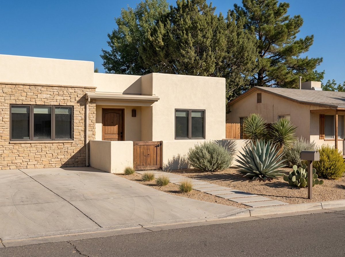
Looking at land in Cornville but not sure how to separate a great parcel from a costly headache? You are not alone. Rural lots can be beautiful and flexible, yet the real story lives in access, utilities, soils, and the rules that shape what you can build. In this guide, you will learn a simple, local process to evaluate Cornville acreage with the same tools builders and county reviewers use. Let’s dive in.
Why Cornville land is different
Cornville is an unincorporated area of Yavapai County, which means most land use, zoning, septic, and building permits run through county departments, not a town hall. Lots range from creek-adjacent acreage to upland ranch tracts, so two parcels that look similar by size can have very different development costs. Your best starting point is the county’s parcel viewer. Use the Yavapai County Interactive Map to pull zoning, flood zone, recorded documents, fire district, water district, and sales history.
Start with parcel homework
Before you make an offer, collect every scrap of data you can. Download the parcel report and any recorded documents from the county map, and ask the seller for prior septic records, well logs, surveys, permits, and utility info. The county’s Development FAQ explains permit basics and how to look up existing records in CitizenServe.
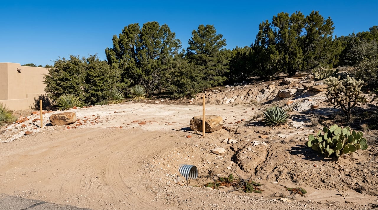
Confirm legal access and roads
Not all dirt roads are created equal. Confirm whether the parcel fronts a public road or depends on a private easement by reviewing the deed, the parcel record, and the GIS layers for roads and easements. Ask for a recent title commitment that lists every easement, right-of-way, and access agreement.
If you will need a new driveway connection across county right-of-way, plan for a driveway or culvert permit through Public Works. On-site, look for signs of seasonal runoff crossing the driveway alignment. A longer or steeper driveway can raise costs and may trigger grading or variance reviews.
Verify utilities and service letters
A raw lot can be a smart buy, but only if you understand what it will cost to bring in power, water, and wastewater. Get written confirmation wherever possible.
Electricity with APS
Arizona Public Service serves most of the Verde Valley. For any parcel, confirm where the nearest point of connection is and whether a line extension is required. Request a written will-serve or construction review through the APS portal to understand scope, timelines, and who pays for upgrades. Start here: APS construction and will-serve.
Water: wells and small systems
Many Cornville parcels rely on private wells or small water companies. If there is an existing well, request the well log and any pump-test results. If no well exists, search nearby well records to gauge drilling depth and conditions using the Arizona Well Registry. Yavapai County’s Environmental Services reviews well-related permits and coordinates with state reviewers for smaller parcels. If a private water company serves the lot, request a formal will-serve or service-availability letter and recent water quality reports.
Wastewater: septic systems
Unsewered parcels need on-site wastewater approval. The county requires a sequence that typically includes a site investigation with test holes, a septic design and permit application, and construction inspection with final approval. Review the steps and submittal requirements on the county’s Septic Permits page. In rocky or shallow soils, plan for an engineered alternative system and get estimates early.
Communications and broadband
Wired broadband can be limited on rural roads in Cornville. Check provider maps ahead of time and test cellular signal on-site. If reliable high-speed internet is a must, include it as a contingency and verify options before you open escrow.
Read the land: topography, soils, and bedrock
Your house, driveway, and septic system all depend on what sits under the surface. The right maps can save you from surprises.
Soils and percolation potential
Start with the NRCS Web Soil Survey to understand soil types, depth to restrictive layers, erosion risk, and general absorption behavior. It is a screening tool, not a substitute for on-site testing, but it helps flag parcels that may require extra engineering. Learn how to pull and interpret maps via the NRCS Web Soil Survey overview.
Geology and shallow bedrock
Upland areas around Cornville can have shallow bedrock that impacts septic fields and excavation. The Arizona Geological Survey’s geologic quadrangle is a useful reference before you order site work. Review the Cornville map sheet (DGM-137) to understand local deposits and structural features: Geologic map of the Cornville quadrangle.
Slopes and drainage swales
Avoid building across natural washes, seeps, or drainage swales that may activate during storms. Steeper slopes raise foundation and driveway costs and can require grading plans. Check the parcel’s relief on a topo survey before finalizing home placement.
Floodplain and Oak Creek proximity
If a parcel touches Oak Creek or related floodways, floodplain status is a top priority. The Oak Creek floodplain was recently re-mapped and new FIRMs in Yavapai County took effect in early 2024. This can affect finished-floor elevations, lender requirements, and insurance. Review the project details and use the Flood Control viewer linked from the county’s Oak Creek Floodplain Remapping Project page before you commit.
Wildfire exposure and defensible space
Cornville’s high-desert landscape carries seasonal wildfire risk. Expect to follow defensible-space practices when you clear and build. Plan your site layout with ignition-resistant zones around structures, keep driveways accessible for emergency vehicles, and confirm any local fire restrictions before heavy equipment work during dry months.
Zoning, uses, and future lot splits
Because Cornville is unincorporated, Yavapai County zoning controls your allowed uses, setbacks, and any special permits. If you plan to add accessory dwellings, run a home-based business, keep certain animals, or split the lot, talk with the Planning Unit early. You can browse rezonings and case histories to understand timelines and hearing processes via the county’s Planning and Zoning Cases page.
Build your total cost-to-develop
Price per acre does not tell you what it costs to build. Add line items for driveway and culvert work, power extension or trenching, well drilling and pump equipment, septic installation, grading and retaining, and communications setup. Ask for written estimates while you are still in your inspection period and compare those totals against improved lots that already include utilities and a septic approval.
A practical due-diligence sequence
Follow this order to save time and reduce surprises:
- Parcel homework
- Pull the parcel on the Yavapai County Interactive Map and download the report and recorded documents.
- Ask the seller for any septic records, well logs, past permits, surveys, and CC&Rs.
- Title and recorded documents
- Order a title commitment that lists easements, access, and restrictions.
- Confirm legal access and road status with your title officer.
- On-site checks
- Walk access routes and look for steep sections or drainage crossings.
- Note utility poles, transformers, and cabinet locations; test cellular signal.
- Technical reviews
- Boundary or ALTA survey to verify corners and easements.
- Topographic survey to site the building pad and driveway.
- Site investigation and perc testing for septic design.
- Well log and any pump test; if no well, review nearby well depths.
- Geotechnical review where shallow bedrock, fill, or slopes are present.
- Utility will-serve letters
- Request written service-availability from APS and any water provider.
- Regulatory confirmations
- Verify setbacks, code editions, driveway permit needs, and floodplain status.
- Use the county Development FAQ to look up permit submittals and routing.
- Cost and go/no-go
- Gather written bids for driveway, power, well, septic, grading, and internet.
- Compare total development cost to your budget and to improved-lot options.
How to think about Cornville land comps
Great land comps focus on buildability, not just acreage. Use the county recorder and the GIS sales layer to confirm closed sales, acreage, and tax status. Pair that with MLS data for photos and notes on wells, septic approvals, and building pads.
When you compare parcels, adjust for:
- Utility status and proximity to power
- Verified water source and any well log or service letter
- Septic approval or existing system
- Usable, buildable acreage versus steep or wash-heavy ground
- View quality and any creek frontage or irrigation rights
- Access quality, road maintenance, and recorded easements
- CC&Rs or restrictions that affect use or design
When inventory is thin, widen your search to nearby areas in the Verde Valley and note differences in access, views, and utility readiness as you adjust pricing.
Quick buyer checklist
Use this short list to keep your evaluation on track:
- Pull parcel on county GIS and download recorded docs and tax history.
- Ask the seller for survey, well log, septic record, permits, and CC&Rs.
- Order a title commitment and confirm legal access and easements.
- If moving forward, order an ALTA boundary and a topo survey.
- Schedule a site investigation and perc test for septic.
- Request will-serve letters from APS and any water provider.
- Check FEMA flood status and Oak Creek remap results if near the creek.
- Confirm fire district and plan for defensible space around structures.
- If subdividing or seeking a variance, contact the county Planning Unit early.
Ready to talk through a specific parcel or walk a lot together? As a local, full-service agent, I can help you interpret county maps, line up the right specialists, and compare development costs so you buy with confidence.
If you are planning to purchase or sell land in Cornville, let’s connect. Reach out to jessie pfeiffer to schedule your consultation and get a practical plan tailored to your goals.
FAQs
What county offices handle permits for Cornville land?
- Yavapai County Development Services oversees zoning, building, septic, and most permits for Cornville since it is unincorporated.
How do I check flood risk near Oak Creek in Cornville?
- Review the county’s Oak Creek remapping resources and the current FEMA maps, then confirm any elevation or insurance needs with your lender and insurer.
What is a will-serve letter and why do I need one?
- A will-serve confirms a utility’s ability to provide service, connection points, and any extension costs, which helps you budget and avoid surprises.
How can I tell if a parcel has legal access?
- Verify access on the deed and parcel map, look for recorded easements, and have your title company confirm rights-of-way and maintenance language.
Do I need a perc test in Cornville before buying?
- If the lot is unsewered, a site investigation and percolation or test-hole work is standard to design a septic system and estimate installation costs.
What should I adjust for when comparing Cornville land sales?
- Focus on utilities, water source, septic approval, usable acreage, views, access quality, and any CC&Rs, since these drive big price differences.